Water level sensor in Poquito Bayou, Okaloosa County. Image courtesy of Laura Tiu.
Does your community experience flooding? Coastal communities face the compound threat of storm surges, extreme rainfall, and rising sea levels. Florida Sea Grant and partners can help.
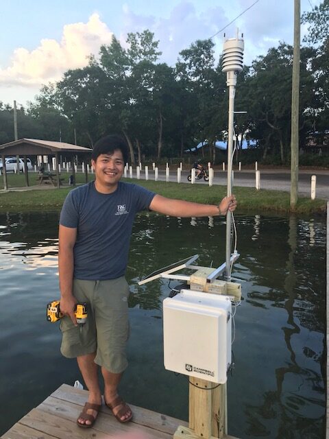
Innovative technology meets coastal resilience in a recent partnership between Florida Sea Grant, Florida Atlantic University (FAU), and the Southeast Coastal Ocean Observing Regional Association (SECOORA). Florida Sea Grant specialists are working with local municipalities, estuary programs, and communities in the placement of water level sensors in 7-counties across the Florida Panhandle. The water level sensors will be installed by FAU, with funding support from SECOORA.
Water level sensors sit above the water and measure the distance from the water to the sensor. The height of the water is collected and relayed in real-time for access on your phone, at home, or in the office. The sensors will help identify current and projected flood susceptibility hotspots based on precipitation-based flooding and allow communities to customize a notification system for alerts when the flooding threshold is exceeded, such as when the roads start to flood.
The sensors can be programmed to measure additional parameters such as wind, saltwater, humidity, and dew point. This information can help local citizens and emergency managers and enhance the safety and resilience of the community.
Mary Gutierrez, the Florida Sea Grant Community Engagement Specialist, is working to identify and confirm optimal water level sensor sites based on watershed locations, geographic features, and accessibility for installation. The seven designated counties include Escambia, Santa Rosa, Okaloosa, Walton, Bay, Gulf, and Franklin.
“It is important to be geographically representative of all Panhandle communities. With regards to sea level rise, we see flooding in coastal areas, but we are also experiencing flooding in the northern parts of counties for other reasons,” says Gutierrez.
The information gathered from the water level sensors will be viewable on the SECOORA data portal. Access to data will allow communities to identify and begin planning future mitigation and adaptation projects, meet current management plan goals, and potentially be used to secure funding through grants and other programs to address potential flooding issues. Portal access support and training will be available in 2024.
“We are incredibly excited that this established program is now being implemented in the Florida Panhandle,” says Gutierrez. “The program not only provides communities and community leaders with valuable information on how to address water-related concerns, but it also allows the citizens of these communities to become actively engaged.”
Three sites have been confirmed for installation in December including:
- Cessna Park, Walton County
- Lions Park in Niceville, Okaloosa County
- Sylvania Heights and W.E. Combs Community in Fort Walton Beach, Okaloosa County
Media Contacts
Mary Gutierrez, Community Engagement Specialist, Florida Sea Grant College Program, [email protected] or 850.549.7472.
Laura Tiu, County Extension Director, Florida Sea Grant Agent, University of Florida IFAS Extension Walton County, [email protected]